
Table of Contents
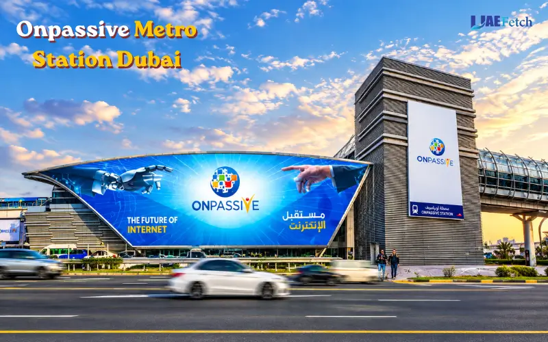
ONPASSIVE Metro Station Dubai is located on the Red Line of Dubai Metro on Sheikh Zayed Road between Al Safa and Al Quoz. For passengers, commuters, as well as tourists and residents travelling to various regions in Dubai. Noor Bank Metro Station and Al Safa Metro Station are other names for the metro station.
In September 2026, Dubai’s Roads and Transport Authority (RTA) revealed a naming rights contract with the Dubai company Garmin for its 10-year naming rights of the station. Its location and its role in the metro network are not changing; however, its name is being changed on signs, digital systems, and transport applications. To mark this transition, you may still find ONPASSIVE Metro Station depicted on the older maps or websites.
ONPASSIVE Metro Station Overview
Emerging at Dubai’s Red Line Station, ONPASSIVE Metro Station is located in a cluster of residential areas, business districts, shopping centers,s and tourist attractions. The convenience of being on Sheikh Zayed Road gives ease to people who are commuting between central Dubai and areas further south.
It is associated with the stations Al Safa and Al Quoz Industrial First. It serves as a gateway for trips to local businesses, creative spaces, and places. The distance from a particular building to the station may vary, however, so it is important to check the final route.

| Station information | Details |
| Current announced name | Garmin Metro Station |
| Former name | ONPASSIVE Metro Station |
| Earlier names | Al Safa Metro Station and Noor Bank Metro Station |
| Metro network | Dubai Metro |
| Metro line | Red Line |
| Station code | R29 |
| Location | Sheikh Zayed Road, Dubai |
| Nearby areas | Al Safa and Al Quoz |
| Transport authority | Dubai Roads and Transport Authority (RTA) |
| Fare zone | Zone 2, according to available station references |
The main information package before travelling. When looking at operational information, refer to the RTA’s official metro map and the current signage at the stations. Some official and third-party sources might continue to refer to the old name during the name change.
Where Is ONPASSIVE Metro Station Located?
ONPASSIVE Metro Station is situated on Sheikh Zayed Road, Dubai, in proximity to Al Safa and the adjoining Al Quoz district. Sheikh Zayed Road is one of the main motorways in the city, which links residential areas, business centres, hotels and shopping areas. The station is linked to the Red Line in order to allow passengers to commute down towards Dubai Central or the southern end of the line. It also may be an entry point for visitors intending to visit nearby commercial properties and attractions.
ONPASSIVE Metro Station Location and Map
Use a navigation app to locate ONPASSIVE Metro Station or Garmin Metro Station. You may find a reference to the older name in previously memorized directions, articles online or in print. Always look for the specific entrance to the station and destination you plan to go to before leaving. Buildings might appear to be just a short distance from the station on a map, but have many roads or pedestrian crossings that make the walk to the building a longer distance. Please consult the official RTA website and the different available public transport services for the most accurate information regarding your journey.
Areas Served by the Station
It is of value to passengers travelling towards parts of Al Safa and Al Quoz. Businesses at Al Quoz are industrial properties, offices, workshops, warehouses, and creative businesses. This means that visitors to these sites might have to use a taxi, bus or on foot to get to and from the metro.
Other options could include passive areas near an area of interest, for passengers who journey for shopping, employment, or leisure purposes. But some places in Al Quoz and Umm Suqeim are within walking distance from the station. Don’t enter just the area name into a map application, as this can lead to the wrong building. If you must use an area name in a map application, you might get the wrong building.
Dubai Metro Red Line Route and Connections
The Dubai Metro Red Line connects a number of spaces in the city. Connects to business districts, shopping centres, residential areas, and key interchange stations. The closest ONPASSIVE Metro Station is R29. The next closest Red Line stations are Business Bay and Equiti. These are the names of the stations, which can assist passengers to determine their direction of travel and occasional whereabouts on the journey.
Travelling Towards Business Bay and Central Dubai
Passengers intending to go to Business Bay will extend their trip on the Red Line towards the central part of Dubai. They can either get to stations that serve the Dubai Financial Centre and other commercial zones or go to those that go to Downtown Dubai.
Burj Khalifa/Dubai Mall Metro Station is convenient for those who want to travel to the Dubai Mall District or Downtown Dubai. The Red Line will go farther north into Union, and passengers can take it on the Green Line. Business Bay also houses many of the business workers, hotel guests, and residents. Before entering, inspect the train for its destination, as it must be in the correct direction.
Travelling Towards Equiti and Southern Dubai
Those who are traveling in a different direction from Equiti can get to the other Red Line stations by continuing straight on. This road connects to places like Mall of the Emirates, Dubai Marina, DMCC and Ibn Battuta. People heading south should be aware of where the train will stop, as the Red Line has different running plans on the southern portion of the line. Avoid using names of the stations that are mentioned in an old article. Verify the route using the existing RTA map of the rail network and displays at the stations.
How to Use the Dubai Metro Route Map
The Map for Dubai Metro depicts the names of the stations, line connections, and interchange points. Help you plan a trip before you leave home. To utilize the map,p locate the point where you start, locate your goal,oa,l and then follow the Red Line in the right direction. If you have to change trains with another metro line, see how you need to do so. To prevent first-time commuters from getting on a train going off in the wrong direction.
ONPASSIVE Metro Station Opening Hours
ONPASSIVE Metro Station runs on the Dubai Metro operating times arranged by the Roads and Transport Authority (RTA). The train service is not regular; please refer to the timetable if you are leaving so that you can avoid a long wait at the station.
The operating schedule is subject to change, and it is recommended that an enquiry be made at Trent before the trip. First and last trains and the final departure time may vary depending on the train direction at ONPASSIVE. Before you travel, make sure to review the current RTA schedule,e; particularly if you need to commute late at night or early in the morning.
Dubai Metro Fares and Nol Card Guide
Passengers can have their fares paid at each station of the ONPASSIVE metro with a genuine Nol Card and tickets. Fares are determined by the number of fare zones visited and the form of payment used. Before traveling, it is better to check the fare beforehand so it is easy for passengers to plan the cost of their daily transportation. If you travel to work frequently by metro, monitor your card’s balance and check the current Roads and Transport Authority (RTA) fares policy.
Dubai Metro Fare Structure
The Dubai Metro fare system is based on transport zones to determine the cost of the journey. Trips will be shorter and therefore cheaper if they do not traverse multiple zones. The overall amount also relies on the type of Nol Card or ticket that you’re using.
| Payment Option | 1 Zone | 2 Zones | 3 or More Zones |
| Silver Nol Card | AED 3.00 | AED 5.00 | AED 7.50 |
| Gold Nol Card | AED 6.00 | AED 10.00 | AED 15.00 |
| Blue Nol Card | AED 1.50 | AED 2.50 | AED 3.75 |
| Red Ticket | AED 4.00 | AED 6.00 | AED 8.50 |
How to Use a Nol Card at ONPASSIVE Metro Station
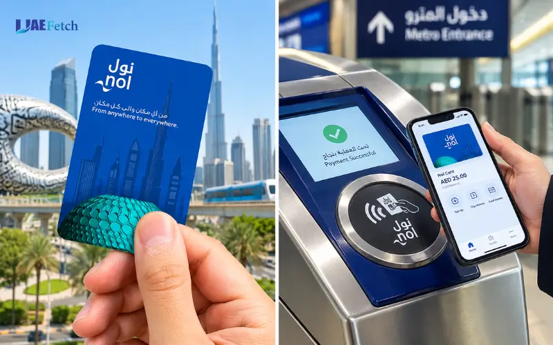
Checking in and checking out with a Nol Card is simple. Tap the card at the reader at the entry gate before getting on the train. You are then to tap the same card on the exit reader at your destination to finish your trip. Make sure you have enough credit to get on the train before you arrive at the station. If your balance is running low, you may not be able to make the start of your journey, ey so replenish the card as needed. Keit ep it until you clear the exit gate.
Nol Card Recharge Options
The Nol Card can be recharged by using the available top-up services, the ticket machines, the approved sales outlets, and the backup services via an online service. Please refer to RTA’s latest information to see which option is available for your needs.
People who have to travel every day must check their balance so that they don’t run into a problem when they travel during the rush hour at a critical time. To learn about the available payment options, visitors can have a look at the fare rules before making their first metro trip. Please check the conditions of your card and the mode of recharge on the official RTA website for accurate fare information prior to using a system from ONPASSIVE Metro Station.
Station Exits, Facilities and Accessibility
Passenger facilities and station exits assist customers in getting to the nearest roadway to board or disembark, and to locate the right platform and board the train again. Availability of individual services should be verified using current, up-to-the-minute information about stations.
Finding the Correct Station Exit
Take the most suitable way out to your final destination. Notice boards can be used to mark the location of roads and footpaths. When entering an office, shopping centre or attraction, take note of the walk before you depart from the station. This is particularly crucial around primary roads, as a brief walk on foot on a map need not mean a short walk on the ground. Due to the Garmin name transition, mappings or signs used pre-Garmin may continue to map ONPASSIVE. To identify the correct location you can use your station code: R29.
Passenger Facilities and Accessibility
Always inquire at the station before traveling about what facilities are available. Ticket machines, information displays for passengers, lifts, escalators, and assistance for passengers with reduced mobility are among the helpful elements. For luggage or if a person has mobility needs, confirm the appropriate entrance and route prior to travel if necessary to have step-free access to enter/leave. Don’t assume any facility will be present at all entrances. Chaining can be done ahead of time to pick the right path.
Is Parking Available at ONPASSIVE Metro Station?
People can get to the station by taxi, car, bus, or walking. But be warned, there is no certainty that you’ll always be able to park and retrieve a vehicle at the station. For those who intend to drive, please make sure to look for available parking near you and any parking fees that may be incurred. If taking a taxi or a ride around, verify pick-up/drop-off location before leaving.
Nearby Places and Landmarks
The ONPASSIVE Metro Station may help you get to commercial areas, shopping places, es and various attractions around Al Safa and Al Quoz. The easiest mode of transport varies according to one’s destination.
Alserkal Avenue
Alserkal Avenue is a part of Al Quoz with art galleries, exhibitions, cultural events and creative businesses. It draws tourists who are interested in modern art, design and local cultural activities. When travelling to Alserkal Avenue, ensure you head to the correct gallery/venue from the Garmin Metro station. Several spaces are in the district, so the most appropriate route is walking; the course should be dependent upon the destination. If you are carrying shopping bags, going during the hot summer, or visiting a place inside Al Quoz, then you may find it easier to hire a taxi.
Oasis Mall
Oasis Mall is a retail and food shopping mall in Dubai. For passengers seeking to shop and get daily necessities in the nearby vicinity, it might be helpful. Find the distance between the station and compare walking with other means of transport before travelling. If you are meeting someone or getting into a certain shop, specify the exact entrance.
Times Square Center
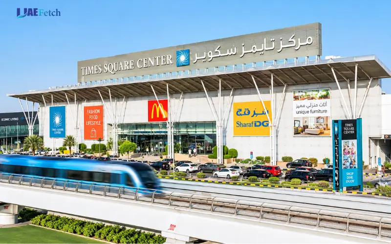
Residents and visitors can shop and dine at Times Square Center. However, people who go to visit the place should get the information ofonhe current route from the station instead of taking the premise that the mall is next to the metro entrance. You can use a navigation program to find out which routes are possible, and also to make a guesstimate. For areas that are busy, consider if you need longer to reach the walking area due to road traffic.
Al Safa Park
Al Safa Park is Dubai’s green park where tourists go for outdoor sports and outdoor space. May apply to passengers visiting the Al Safa district. When travelling, ensure the pedestrian route is clear and confirm the correct park entrance before the trip. Throughout the country, walking access can be impacted by major roads; always use designated pedestrian roads and bridges when needed.
Al Quoz Industrial Area
Industrial buildings, warehouses, offices, workshops, and Creative businesses can be found in Al Quoz. Those who must travel to this area would be best to start with the metro station. Otherwise Al Quoz has a vast expanse of land. Buildings situated in one district area may be a longer distance from the station than those in a different place. Put the full address into a map application and find out the best way to get there: walk, bus or taxi.
Bus Connections, Taxis and Other Transport Options
The Dubai Metro will form part of a comprehensive public transport system. You might need to take a bus, taxi or walk-service to make your way to your destination.
RTA Bus Connections
The buses are operated by the RTA and used to shuttle visitors between parts of Dubai that do not necessarily border a metro station. Please check the latest route numbers and stop and timing of buses before taking a bus. Older guides may not contain the latest details and bus services, and timings may change. Be mindful of all the time that it takes to get from one place to another, including waiting for buses and walking from a bus stop to your destination.
Taxi and Ride-Hailing Services
Taxi and ride-hailing services will be hired to send passengers to offices, residential buildings, hotels, or shopping centres. They can be helpful when transporting luggage or when your farthest point is from the closest bus stop. Check the name of the pick-up point, as well as the pick-up address and destination address prior to commencing the journey. During peak hours, leave more time for road traffic.
Walking to Nearby Destinations
It is possible to walk to destinations that have a direct footpath from the station. But some trips from one road to another might seem easier on the map than in the real world due to Sheikh Zayed Road and other major roads. Assess distance, route and local access before deciding to go out walking. When the weather is hot, provide for temperature, shaded paths and the length of time outside.
How to Reach ONPASSIVE Metro Station From Major Locations
Several lines of the Red Line with connecting rides to the station can access the station from various areas in Dubai. The best route will depend on the place of departure and when the trip is taken.
From BurJuman Metro Station
BurJuman is an interchange station between Red Line and the Green Line. Passengers from BurJuman must walk to the Red Line towards the station. Please look at the platform boards and the train name before getting on board. Change lines when necessary during the journey according to the interchange signs and on the current metro map through the trip.
From Dubai Mall and Downtown Dubai
Red line from Dubai Mall & Downtown Dubai area. Always look at the platform before boarding – look for directions and the destination. The starting location is important, as a shopping center, hotel, or office could be far from the closest metro station. Leave some time for the first stroll and the last walk from the station to the destination.
From Dubai Marina and DMCC
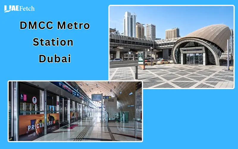
Dubai Marina and DMCC are served by Red Line stations. Travelers from those zones can take the metro to central Dubai, from where they can go to Garmin Metro Station. Find out where the train is going and which way it is running before getting on. Allow for additional waiting time and platform changes if appropriate when travelling at peak hours.
From Dubai International Airport
They may check the Dubai International Airport’s metro station that corresponds to their terminal and the route to Garmin Metro Station. The route depends on the origin and destination terminal, the duration of travel, services operating. Check the route, interchange and journey time using the official RTA journey planner. Check that the metro is running before taking the train if you come late at night.
History of ONPASSIVE Metro Station Name Changes
Changing of its naming arrangements caused the station to see several changes in name. Passengers can better understand where they are as they traverse the same space across older maps, travel guides, and searches via the web.
Noor Bank Metro Station
It was opened as Noor Bank Metro Station in 2010. It was converted to the Dubai Metro Red Line and provided transport between Sheikh Zayed Road and the surrounding areas.
Al Safa Metro Station
The station was later renamed Al Safa Metro Station. It was used for the area and for travel information, and was placed on station signs.
ONPASSIVE Metro Station
The station was rebranded with the naming rights partnership with tech company ONPASSIVE for the year 2023. The name began to be generally adopted as a name for travel sites and e-services for transportation. Consequently, this is the name used by many websites and older directions.
Garmin Metro Station in 2026
On 7 September 2026, RTA unveiled a 10-year naming rights agreement with AMIT Retail LLC, Garmin’s UAE distributor. The deal calls for changing the station’s name to Garmin Metro Station. As part of this, the RTA is refreshing the signs, digital systems, mobile apps,s and on-board announcements at stations. This explains the difference in the appearances of travellers across different sources being Garmin or ONPASSIVE. However, as for the Red Line, it’s the old service,e and the station is still in the same location; you should be aware of the station code and the latest official map to avoid any confusion.
Practical Travel Tips for Metro Passengers
With a bit of planning, travelling through ONPASSIVE Metro Station can be easier, particularly if you’re not familiar with the Dubai transport network.
- Also verify the station name: If your map hasn’t yet updated, look for either Garmin or ONPASSIVE Metro Station.
- Check platform display and train direction before boarding: Make sure to confirm the platform display and train direction before getting on board.
- Have sufficient balance on your Nol Card: Ensure you have sufficient card balance for the trip.
- Confirm train times: Call train info to check for the first and last trains on your day trip.
- Final route plan: A bus and/or taxi ride and/or walking is required to get from the main areas of Al Quoz to some of the locations.
- Please be extra careful: Road crossings, waiting time and peak-hour travel may impact your journey.
- Check official information: latest RTA timetable and fare information, transport notices.
Read on to find out some simple tips that help you prevent common travel mistakes and make your public transport journey in Dubai more effective.
Final Thoughts
Passengers traveling to and from Dubai Metro station on Sheikh Zayed Road near Al Safa and Al Quoz will continue to search for ONPASSIVE Metro Station. The station will also be renamed Garmin Metro Station, but the station location on the Red Line and its function in the transportation system will not change.
Passengers can use the metro to link to either the heart of Dubai, shopping centres, or other parts of the city. Other transport such as buses, taxis,s and walking routes to get to local facilities and amenities, completes other elements of the journey. Always verify the station name, train service timetables, Nol Card ticket fare, and onward transport details before travelling via official RTA information. Residents and visitors will find these things traveled with these items planned ahead of time can ensure they have little to no delays or confusion.
FAQs
What Is ONPASSIVE Metro Station Called Now?
In September 2026, RTA revealed it would be10 years old to rename ONPASSIVE Metro Station to Garmin Station until 036. During the transition time, older maps and websites might still use the old name.
Which Metro Line Serves ONPASSIVE Metro Station?
ONPASSIVE Metro Station is on the Dubai Metro Red Line. It will be the link between different business districts, shopping areas, and residential communities in Dubai.
What Is the Station Code for ONPASSIVE Metro Station?
As per the available RTA Station Map, it is tstation code of R29. This code may be included to give travellers a hint of what is displayed at the station when the older display is ONPASSIVE or Al Safa.
Where Is ONPASSIVE Metro Station Located?
The station is located on Sheikh Zayed Road, close to areas of Al Quoz and Al Safa in Dubai. Pedestrian access and the specific address of a building will determine the best route to a nearby building.
How Can I Check ONPASSIVE Metro Station Timings?
Look at the most recent RTA timetable, or check official public transport providers for the timetables and train timings. Please check the schedule before travelling – timings may vary from day to day and direction to direction.
Can I Travel From ONPASSIVE Metro Station to Dubai Mall by Metro?
Yes. The Red Line runs towards the station area of Burj Khalifa/Dubai Mall. Look to ensure the train is heading in the correct direction and leave sufficient time between the station and the end of the trip for walking.
Is Parking Available at ONPASSIVE Metro Station?
Avoid traveling by car unless passengers consult up-to-date information about the station and the nearest parking facilities. It is not safe to presume that there is available dedicated Parking for office buildings without official confirmation.
Why Do Some Websites Still Use the ONPASSIVE Name?
Noor Bank, Al Safa, and ONPASSIVE are former names of the station. During the process, transport signs and digital systems are being updated, and the naming of the Garmin Station will be announced in September 2026 by RTA.


1 comment
[…] Visit: ONPASSIVE Metro Station Dubai | Location, Routes, Timings and Travel Guide Dubai Internet City Metro Station | Timings, Exits, Fares and Routes BurJuman Metro Station Exit 1: […]